Industry workflows
Drone operations for Surveying & Mapping
Reduce missing-input handoffs between field capture and processing. Keep coverage, ground references and output criteria together so the qualified reviewer can assess the resulting dataset.
Bring the workflow, responsible people and the handoff you want to improve. Our team will review your request and follow up by email.
Agree the evidence and the person who will use it.
A useful brief names the required result, operating constraints and review responsibility.
Target boundary, coordinate reference, control requirements, capture method, requested formats and acceptance criteria.
- Define the requested output and its intended recipient.
- Confirm access, readiness and the responsible operating roles.
- Record exclusions and the decision needed when evidence is missing.
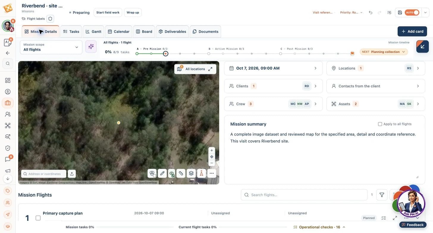
Riverbend · mapping capture handoff
Follow the brief through preparation, a consequential choice and a reviewed output.
Illustrative workflow · AI advances routine execution; your team owns critical decisions.
Riverbend · mapping capture handoff
Illustrative product workflow. Sample screens show the named operating context; they are not customer results.
Prepare the work
- Input
- Target boundary, coordinate reference, control requirements, capture method, requested formats and acceptance criteria.
- Product or agent contribution
- PM organizes control and capture tasks; the field team records source files, flight references and coverage limitations for the external processing workflow.
Resulting output
A reviewed scope, readiness checks and a named next-action owner.
Review and hand off
- Input
- Source evidence and the agreed acceptance criteria.
- Product or agent contribution
- AI organizes the evidence references, versions and specific review follow-ups so the team can close gaps without restarting the brief.
Resulting output
A source manifest, control references, capture limitations and processing handoff, followed by reviewed mapping outputs in the agreed reference and formats.
Resources for this operating context
9 relevant entries in the curated collection: 2 core workflows and 7 worked examples. Start with these previews.
Choose a workflow by its intended scope and expected output. Worked examples illustrate specific situations; adapt them to your operation and qualified review requirements.
Orthomosaic Mapping
Take mapping work from agreed coverage and ground reference through field quality checks and an externally processed, reviewed orthomosaic. Use the prepared workflow to organize planning requirements and outstanding checks, reducing avoidable rework while the survey team validates the map and its accuracy.
Core workflow
Preview workflowLiDAR Topographic Surveys
Keep calibration, ground reference, payload recordings and processing handoffs together from field capture to reviewed terrain products. Use the prepared workflow to coordinate the required inputs and follow-ups, reducing time spent chasing missing files while specialists validate the point cloud and terrain model.
Core workflow
Preview workflowRemote LiDAR & Panorama Capture
Prepare remote LiDAR work with ground-reference records, panoramas, battery continuations and complete source packages kept together. Use this example to organize departure readiness and missing-input follow-ups, reducing coordination overhead and the risk of another journey for omitted work.
Worked example
Preview workflow
Worked examples illustrate workflows, not customer endorsements. Processing, technical interpretation and critical operating decisions remain with the responsible people and tools.
Carry your industry into your first step
Explore authored mission templates relevant to Surveying & Mapping, including capture instructions, expected evidence and review requirements.
Bring the workflow, responsible people and the handoff you want to improve. Our team will review your request and follow up by email.